Tucson International Airport (TUS)
Orientation and Maps
(Tucson, Arizona (AZ), USA)
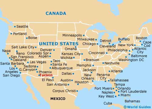
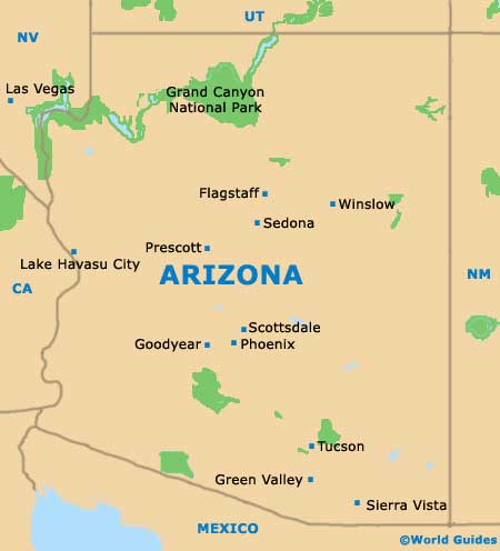
The second-biggest city in the whole of Arizona, Tucson is known for its Latino heritage. Located in the southwest and home to the highly acclaimed University of Arizona, the city of Tucson lies close to Phoenix, which is approximately 115 miles / 185 km to the northwest.
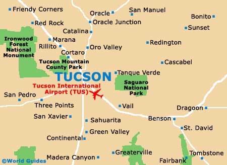
To the south you will find Tucson International Airport (TUS), with Arizona Stagecoach buses providing door-to-door transport to many areas of the city. Located along the East Toole Avenue, Tucson's Amtrak train station features regular trains that run to Phoenix in around two hours and also link Los Angeles, which can be reached in just over nine hours. Also worth noting, the Ronstadt Center can be found on the corner of both 6th Avenue and Congress Street, and is an important local transit center.
Tucson International Airport (TUS) Maps: Important City Districts
Central Tucson features a stunning backdrop of mountainous scenery and many attractive 19th-century buildings stand in the downtown area. Both the city's historic district and downtown Tucson lie to the east of the I-10 interstate, with the point at which Congress Street and Stone Avenue intersect marking the very heart of the city. This is the official starting point for all of the city's addresses and a useful spot to reference.
One of the main thoroughfares in Tucson is the busy 4th Avenue, which is close to the university and lined with shops and trendy bars. Those looking for tourist information and maps of the area should visit the Tucson Convention and Visitors Bureau along South Church Street, which is open Monday through Sunday.
USA Map
Arizona Map
Tucson Map